Gardabani municipality is located in the South of the country, near the Azerbaijani border. Territory begins among the slopes of Kojori-Sakaraulo, Mtatsminda, Tabori and Teleti and on its way to South it gradually turns into a plain. The bulk of the municipality border is accompanied by Georgia’s and Transcaucasia’s longest river Mtkvari. On the bank of river Mtkvari, between Teleti slope and Yagluja highland, on the Kumisi hollow, is situated the hamlet of Kumisi – upper-belt peloid and health resort area noted for its medicinal mud. The therapeutic mud is extracted from artificial lake located in the Southeastern part of the village the floor of which is covered with pseudo-volcanic-origin mud having high quality medicinal properties. The thickness of the silt is several tens of sm. The mud is actively used at Tbilisi Spa Resort. Up to the middle of the last century, on the place of
today’s Kumisi Lake there was a small (0.48 sq.km) salty lake of pseudo-karst origin with a big content of Glauber’s salts. In the 1960-ies the basin of the lake was filled with waters of river Mtkvari. The water level went up and lake became desalinized. Today the basin area of Kumisi Lake is 97 sq. km, and surface area roughly 5 sq. km. The length is 3 km, width – 1 km. The depth of the Lake according to the changing level of water, hovers from 4 to 6 meters. The lakeside is covered with sedge grass and the reeds that are good refuge for water birds.
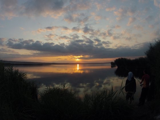
1. Kumisi Lake. There are lots of mullet, silver carp, common carp, cat-fish, minnows, barbell and other species of fish. Nearby
there is a fishing farm that is very popular among the lovers of fishing.
2. Gardabani Managed Preserved Territory. Located on the border of Gardabani and Marneuli municipalities, not far from
Azerbaijani border. Founded in 1996. Area 3 484 ha. Its main wealth is plain forests and representatives of its fauna, among
them red deer was included in the ‘Red List’ of Georgia. It is possible to sightsee a lot of historical monuments on the territory
of Managed Preserve. Among them is worth mentioning David Garedji monastery complex established in IV c. The complex
consists of David’s Monastery, Udabno, Natlismtsemeli, Verangareja, Chichkhituri, Dodo’s Horn, Tetri Senakebi…
Location: between Yagluja highland and Tsalaskuri plain, to the North-Western direction from Kumisi Lake
Distance: 20 km away from Tbilisi
Sea level: 480 m
Landscape: hillocky plain
Climate: mild, continental, dry, winter soft, with little snow, mean temperature in January 0 degrees centigrade; summer hot, dry, mean temperature in August 24 degrees centigrade
Average annual precipitation: 550 mm
Average comparative annual humidity: 68%
Duration of annual sunny light: 2200 h.
Natural treatment factors: low mountain climate and Kumisi Lake sulfide silt therapeutic mud containing
silicon, aluminum, iron oxides and other biologically active ingredients. Besides, Kumisi Lake water – chloridesulphate,
magnesium-calcium-sodium mineral water with general mineralization of 15-25 g/dm3
Types of therapy: therapeutic mud baths and applications, passive climate therapy
Diseases for treatment: cardiovascular, gynecological and musculoskeletal system diseases, chronic pyelonephritis and nephritis, cystitis, chronic gastritis, colitis and enterocolitis, chronic hepatitis, and also nervous system
disorders: radiculitis, sciatica, encephalitis
 GEO
GEO ENG
ENG RUS
RUS Forum
Forum