Gujareti – gorge of river Gujarula – is a historical region of Georgia and a hub connecting Javakheti and Trialeti with Shida Kartli by
means of important transit routes. Having been settled since the Bronze Age up to the end of XVI century, population of this region like the whole of Southern Georgia had to move and resettle to the central parts of the nation. They returned back only in the 30-ies of XIX century when according to the Adrianopol Peace Treaty of 1829 between Russia and the Ottoman Empire, Georgia and its historical regions were liberated from the Ottoman rule. Mitarbula is a left tributary of river Gujaretistskali. Resort of Mitarbi belonging to the Borjomi group of health resorts is located on the Northern slope of Trialeti range, on the riverside. In a highland village 25 km away from Borjomi, resort infrastructure is nearly nonexistent, but mineral water springs available there are known and popular. Mineral water has peculiar taste and therapeutic properties. Mitarbi water has been distributed to Tsagveri by water mains where it had been bottled for commerce
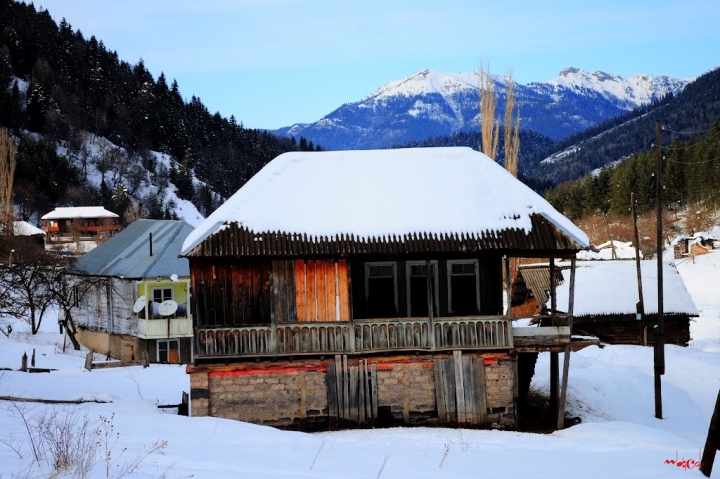
since 1970-ies of the last century. In the 1980-ies development of mountain ski resort infrastructure was planned in Mitarbi. For this purpose here are due conditions of nature, like stable snow cover and mountain slopes of pertinent tilt. Several years even skiing trail was operated here. However, project was not given a go-ahead. Kokhta-Mitarbi mountain skiing and tourist complex development stays a viable project also for the time being.
1. Tsero Lake. Situated on the Northern slope of Trialeti range, on the lava plateau of Dabadzveli, on 1808 m altitude above sea level. Surface area 0,02 sq.km, basin volume 0,62 sq.km, maximum depth 6,6 m, water fresh and clean. No fish in the Lake.
2. ‘Panorama trail’ at Borjomi-Kharagauli National Park. There are 11 walking paths in the Park. Natural conditions – mountains, climate and proximity to Borjomi-Kharagauli National Park – makes Gujareti gorge attractive for hiking lovers.
Location: Borjomi gorge, bank of river Mitarbula, includes two villages (Didi and Patara Mitarbi)
Sea level: Didi Mitarbi – 1480 m, Patara Mitarbi – 1300 m
Distance: 25 km away from Borjomi, 175 km away from Tbilisi
Landscape: mountainous
Climate: middle mountain (lower belt), transitional from continental-subtropical to maritime subtropical; in Didi Mitarbi winter moderately cold, mean temperature in January -2,9 degrees centigrade; in Patara Mitarbi winter cold, mean temperature in January -3,1 degrees; in both villages winter period has stable snow cover; summer cool, moderately dry, mean temperature in August in Didi Mitarbi 18
degrees, in Patara Mitarbi 18,2 degrees centigrade
Average annual precipitation: 800 mm
Average comparative annual humidity: 77%
Annual average number of sunlight hours: 2050-2100 h.
Natural treatment factor: climate of middle mountain, lower belt, carbohydrate, calcium-sodium mineral waters with general mineralization 3,8-4,2 g/dm3;
discharge: 100-110 thous. l/day
Types of therapy: application (drinking) of mineral water, passive climate therapy Diseases for treatment: alimentary tract diseases, including chronic gastritis, stomach and duodenum ulcer, colitis and enterocolitis.
 GEO
GEO ENG
ENG RUS
RUS Forum
Forum