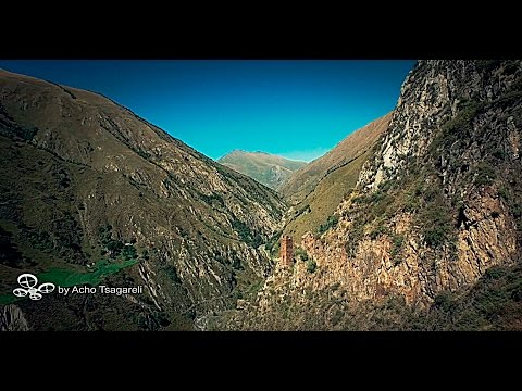
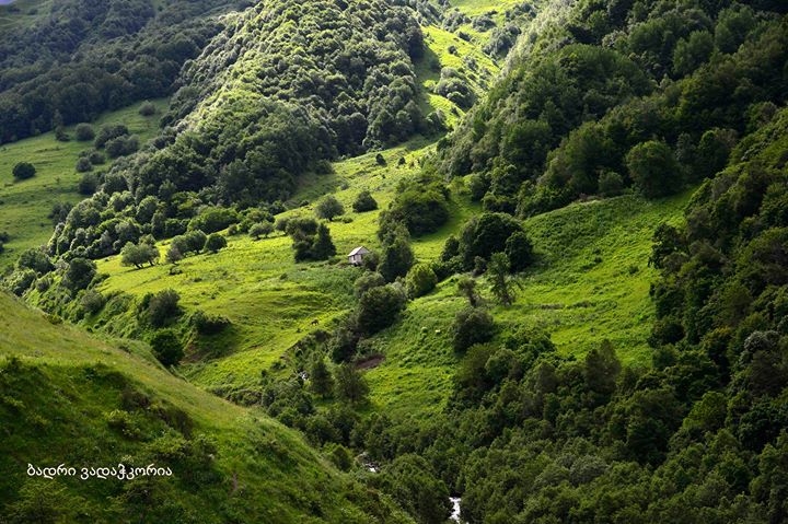
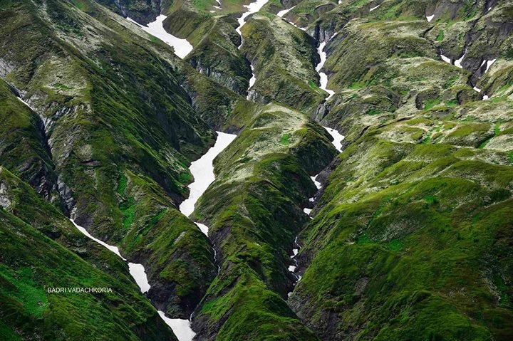
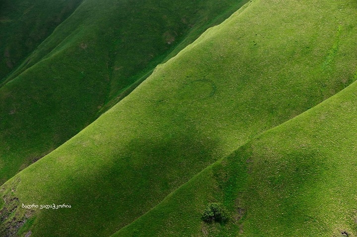
Pshavi Aragvi gorge starts on the 60th km of the Georgian Military Road, North of Tbilisi. Parallel to the gorge the road leads up to the historical Pkhovi – Pshav-Khevsureti. Situated on the border of Kartli-Kakheti, Pshavi is settled on the elevation of 1000-3218 m above sea level, therefore there are practically no peaks with perpetual snowy summits, while high mountains for Khevsureti are first and foremost typical. Moniker ‘Khevsureti’ was given to the region for mountainous terrain with many gorges (‘Khevi’ in Georgian means ‘Gorge’). The main watershed ridge of the Kavkasioni and Datvisjvari pass (2677 m) link Aragvi gorge with Arguni gorge (Pirikita Khevsureti – Thither Khevsureti). The pass is closed in winter due to high snow cover, therefore Pirikita Khevsureti most part of the
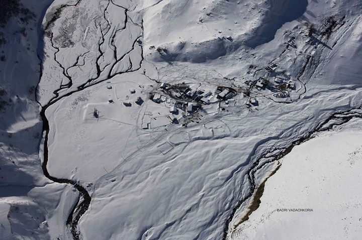
year is separated from outer world. Khevsureti is a borderline region: from the North it is bordered by Chechnya and Ingushetia. For centuries Khevsurs were reliable border guards of the nation from invading enemy. Non-stop military alertness was the cause of special architectural appearance of villages in Khevsureti: each settlement is virtually a stand-alone fortification establishment that is simultaneously an abode. The largest village of Pirikita Khevsureti and principal settlement of the region is Shatili which is a striking specimen of unique architecture typical for Khevsureti. Fortress-houses with sunshades are lined up on the rocky slopes in terrace-style with walls constructed from shale stones attached to each other so closely that they prevent even a sun beam to go through. Houses are connected with each other by narrow stone stairs, and a stranger entering a village may cross it from one end to the other without touching ground. Most of the surviving fortress-houses were erected in later Middle Ages, however settlement remnants discovered in the environs of Shatili date far back to earlier periods – 2000 years BC. Hamlet of Mutso (1880 m above sea level) situated 12-15 km away from Shatili to the North-East is a unique fortification establishment where up to 40 houses and ruins of domestic and defense purposes have survived up to the present. Mutso as well as about 20 hamlets of Pirikita Khevsureti in the course
of last hundred years became gradually deserted. If in 1898 5000 households lived (including in Shatili – 50), today only several
residents live in Shatili the whole year. In April, 2014, the government of Georgia issued a resolution stipulating foundation of Pshav-Khevsureti Preserved Territory which will facilitate protection of numerous monuments of cultural heritage (unique towers and houses) as well as unique ethnology and culture of the region. The Preserved Territory will include also Roshki Natural Monument, Asa Managed Preserved Territory and Pshav-Khevsureti Various Use Territory. In 1956, on the bank of river Pshavis Aragvi, near the village of Chargali, geologists looking for mineral water springs made 26 gushers to the depth of 40-250 meters. All of them turned out to bring fruits. Six springs were given the category of drinking water, as to the rest of spring waters, their curing properties were revealed. In 1967 spa center was opened near Chargali. In 1961 water bottling factory was built where production of mineral water labeled ‘Vazha’s Tskaro’ started.
1. Every year, in the beginning of August, popular festival ‘Shatiloba’ is held in Shatili.
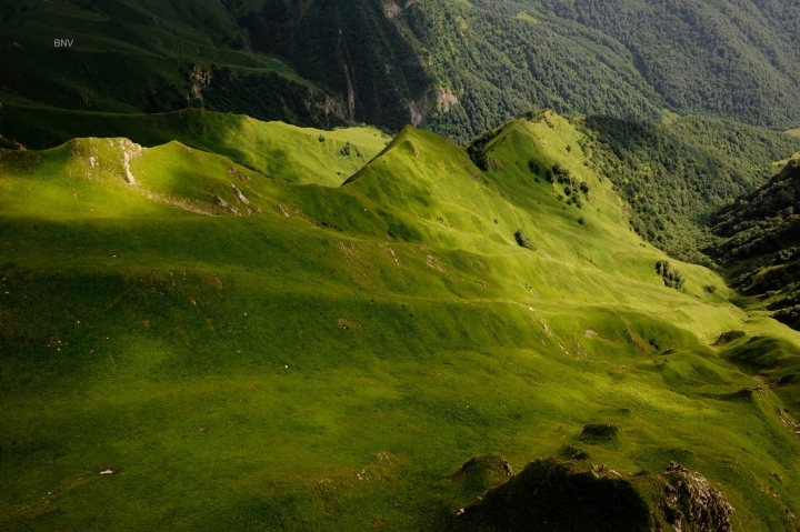
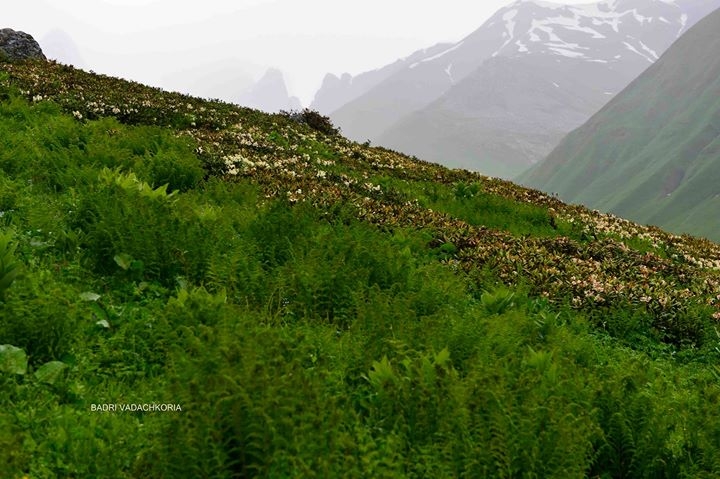
2. Lakes of Abudelauri and Chaukhi mountain. Chaukhi is located on the main range of Pshav-Khevsureti segment of Kavkasioni,
3842 m above sea level. Its structure consists of Jurassic clay, shale and limestone materials. It links gorges of rivers
Jutistskali (right tributary of river Tergi) and Abudelauri (basin of Khevsureti Aragvi). In its foot there are color lakes (2812 m) of
Abudelauri glacier (moraine) origin. The largest among the three lakes has the area of 0,035 sq.km, maximum depth 3,8 m, volume 45 000 m3. Gets its feed from snow, glacier and rain water and has outflows. For a long time (more than 6 months) remains frozen. There is no fish in the lake.
3. Mutso.
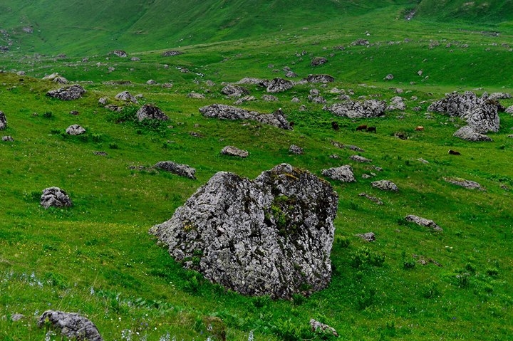
4. Abudelauri (Roshka) boulders. Village of Roshka. Abudelauri gorge. 1850-1900 m above sea level. Boulders of 19x5x7 and 22x13x10 size created from magma rocks – diabase belong to the largest erratic (crawling) boulders in the world. There are
even bigger boulders of 25 m length further from the village. In the highland parts of Abudelauri gorge and in the gorge of river Aragvi there are comparatively smaller erratic boulders. These boulders were carried over from Chaukhi massif by largest pleistocene age glacier. It should be noted that years ago the end of the glacier was fixed on the elevation of 1450 m, but due to melting its height today attains 2300 m.
Location: middle zone of Greater Kavkasioni, near settlement of Chargali
Distance: 80 km away from Tbilisi
Sea level: 980 m
Landscape: mountainous
Climate: low mountain climate, winter cold and rather snowy, mean temperature in January -4,7 degrees centigrade; summer warm, mean temperature in August 18,6 degrees centigrade
Average annual precipitation: 1000 mm
Average comparative annual humidity: 72%
Duration of annual sunny light: 2100 h.
Natural treatment factors: Low mountain climate and carbohydrate, silicon, boron, chloride-hydro-carbonate, sodium-iron mineral waters with general mineralization of 1,3-27,2 g/dm3, and carbohydrate- hydro-carbonate, sodium-calcium (and calcium-sodium), iron mineral waters with general mineralization of 2,5-11,8 g/dm3
Types of treatment: mineral water baths and drinking, passive climate therapy
Diseases for treatment: musculoskeletal and alimentary tract system diseases
 GEO
GEO ENG
ENG RUS
RUS Forum
Forum